Rwamera - Satellite Crop Monitoring with Cloud-Aware Field Maps and Agronomist Triage
Crop Monitoring Console for a Rwandan Agronomy Firm
Designed and built a clickable crop monitoring console for a Kigali agronomy advisory firm serving tea, maize and avocado growers: satellite index maps per field with cloud masked out, a queue of stress anomalies to triage, scouting photos with an advisory-only AI suggestion, and advice that cannot name an unregistered pesticide or reach a grower without senior approval.
Most of our work is under NDA. Per agreement, we can share the work but not the company details - all names and identifying information shown here have been changed.
Impact
Dashboard, fields list, field detail, anomaly queue and scouting review, with the anomaly panel, photo viewer, new recommendation and plan visit sheets. Each of the 30 demo fields opens its own detail page.
A satellite scene is only used for a field when at least 60% of its pixels are clear. Scenes below that are greyed out, and cloud and shadow pixels are hatched on the map, never coloured as crop.
Agrochemicals come only from the product register. Expired products and products not registered for the crop are blocked, and any advice that names one is submitted to a senior agronomist before it reaches the grower.
24 growers across 11 districts, 18 anomalies, 14 scouting reports, 7 recommendations, 6 field visits, a 5-product register and season rainfall against normal by district.
The Problem
Rebero's 11 agronomists covered about 400 growers by motorbike and WhatsApp, visiting fields on a fixed rota. A maize field hit by fall armyworm or a tea block under drought stress was often found two or three weeks late, growers sent photos with no field or date attached, advice was given by phone and never written down, and an earlier satellite dashboard showed cloud as crop failure.
Our Solution
Rwamera turns satellite imagery into a daily work list for Rebero's agronomists. Every field has an NDVI and NDRE map clipped to its walked boundary with cloud masked out, stress is raised as an anomaly that an agronomist triages before the grower is told, scouting photos arrive tied to a field, and advice is written, checked against the product register and approved in one place.
The Challenge: Reading Small Fields Under Cloud
Rebero's growers farm tea, maize and avocado on small, steep plots in a country with two rainy seasons. The imagery is free but often cloudy, the growers are often offline, and every piece of advice that names a pesticide has legal and export consequences.
Cloud That Looks Like Crop Failure
Rwanda's rainy seasons bring long cloudy gaps. Cloud and shadow must be masked from the Sentinel-2 Level-2A scene classification, and a field with no clear scene has to say so with a date instead of showing stale or cloudy data as current.
Plots Only a Few Pixels Wide
Sentinel-2 visible and near-infrared bands are 10 m pixels and the red-edge bands for NDRE are 20 m, so a plot under 0.05 ha is only about 5 pixels. The index for those fields can only ever be indicative.
Advice That Must Stay Within the Register
Only agrochemicals registered for use in Rwanda may be recommended, each for its registered crops, dose and pre-harvest interval. Tea and avocado sold for export must also meet buyers' residue limits, so a wrong product or dose cannot be allowed to reach a grower.
Grower Data Under Law No. 058/2021
Growers' names, phones, locations and field boundaries are personal data under Rwanda's data protection law, supervised by NCSA. Consent is recorded per purpose and channel, and imagery processors abroad may only receive pseudonymised field geometry.
Our Approach: From Field Rules to a Clickable Console
Spec and Rules Research
Mapped 8 roles from grower to data protection officer, 40 screens across the agronomist console, a low-bandwidth grower app and a public shared report, the SMS and USSD menu tree, and the data model for fields, scenes, observations, alert rules, anomalies, scouting reports, the product register, recommendations, visits and consents. Wrote down the rules the design follows: Law No. 058/2021, agrochemical registration, AI as advisory only, Copernicus licensing and attribution, and what 10 m and 20 m pixels can show.
Clickable Demo on a Production UI Kit
Built the agronomist console's 5 key screens on a production dashboard kit: the dashboard with portfolio health, crop health by crop and rainfall against normal by district, the fields list with health filters and boundary approval, field detail with the index map, scene strip and health tabs, the anomaly queue with before and after maps, and scouting review with the photo viewer. Triage, diagnosis, visit planning and new recommendations all run on local state.
What a Production Build Adds
Integration with the Copernicus Data Space Ecosystem, Sentinel Hub or Google Earth Engine for index processing, optional PlanetScope imagery, CHIRPS and Meteo Rwanda weather, Africa's Talking for SMS and USSD over MTN and Airtel, and a hosted pest and disease image model. Staff auth by role, an append-only audit log, hosting in a Rwandan region, and the remaining screens: the offline grower app in Kinyarwanda, portfolio map, imagery and processing jobs, consent-checked buyer reports and the privacy console.
Why It Works: Imagery an Agronomist Can Trust
Cloud Is Shown, Never Guessed
Each scene in the strip shows its source and the field's clear-pixel share, and scenes under 60% are greyed out. Hatched pixels read as no data, fields under 0.05 ha carry a small-field flag, and a cloud gap notice counts the fields with no clear image and dates their last usable scene.
Every Anomaly Shows Its Rule
The anomaly panel shows the index change, affected share of the field, clear pixels, 14 days of rain and heat, recent scouting and the versioned rule that raised it. Age turns amber after 24 and red after 48 working hours, and growers are only told after triage.
The AI Only Suggests
Scouting cards carry a Suggestion only label with the top 3 problems and confidence, and whether the photo was taken inside the field boundary. An agronomist confirms or corrects the diagnosis from the crop's problem list, and that choice is kept as feedback for the model.
Advice Checked Before It Is Sent
The recommendation sheet picks products from the register only, converts the dose to the field's area, adds a safety block with protective equipment, re-entry time and days before harvest, previews the SMS with a character count and shows whether senior approval is required.
Related case studies
View all: Agriculture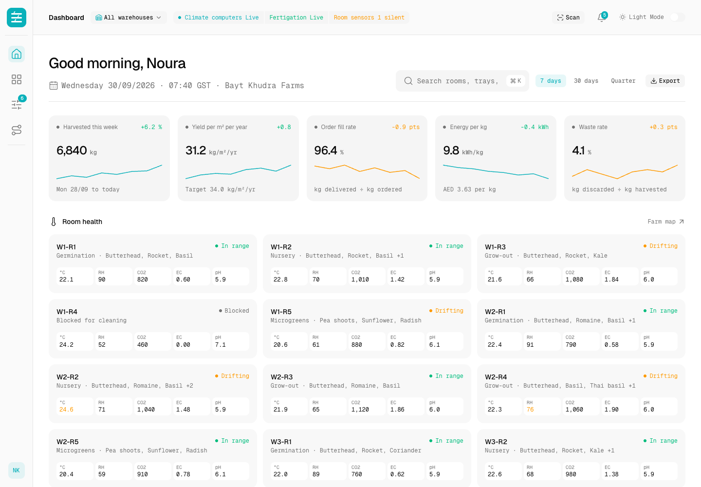
Stacks - Vertical Farm Operations Platform with Human-Approved Climate Control
Designed and built a clickable operations platform for an indoor vertical farm in Dubai growing leafy greens, herbs and microgreens across 3 warehouses: room health against recipe bands, a farm map down to every rack and tray, setpoint suggestions that a head grower must approve, and a lot trace from seed lot to customer.
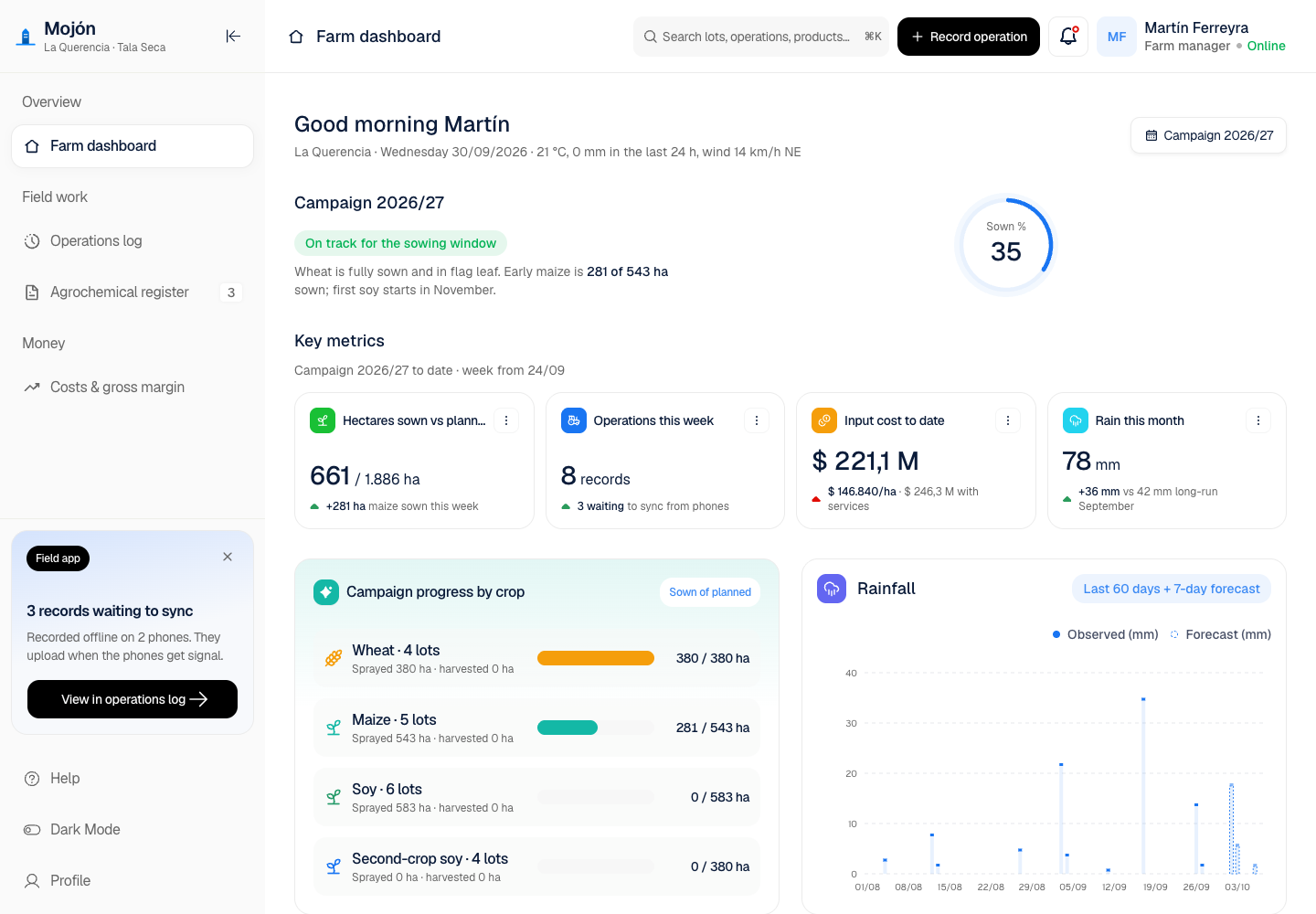
Mojón - Farm Management with Offline Field Records and a Cooperative Console
Designed and built a clickable farm management app for the member farms of a grain cooperative in Córdoba, Argentina: a field operations log, an agrochemical register that ties every spray to a signed agronomic prescription, application records ready for inspectors and grain buyers, and costs and gross margin per lot. The full design adds an offline mobile field app and a cooperative console.
Enterprise Software Engineering - Human + AI
Contact Us
© 2026 - Copyright. All Rights reserved Oceanlab
Location
Global Headquarters
21 Merchant Road, 3rd Floor, Singapore 058267
Main corporate office and leadership operations
North America Office
548 Market Street, PMB 12345, San Francisco, CA 94104
Client operations and business development
India Office
402 Shivalik Shilp II, SG Highway, Ahmedabad 380015
Engineering and delivery center

Enterprise Software Engineering - Human + AI
Contact Us
Locations
Global Headquarters
21 Merchant Road, 3rd Floor, Singapore 058267
Main corporate office and leadership operations
North America Office
548 Market Street, PMB 12345, San Francisco, CA 94104
Client operations and business development
India Office
402 Shivalik Shilp II, SG Highway, Ahmedabad 380015
Engineering and delivery center
© 2026 - Copyright. All Rights reserved Oceanlab