Ranger Line - Anti-Poaching Ops Room Console with Evidence Chain of Custody
Anti-Poaching Operations for a Botswana Wildlife Reserve
Designed and built a clickable ops room console for a conservation trust protecting rhino, elephant and pangolin on a 3,000 km² reserve near Maun: a live map of patrols and ranger positions, sensor alerts verified by a person, and incidents with photos, evidence and an unbroken chain of custody - with exact rhino locations shown only to cleared staff.
Most of our work is under NDA. Per agreement, we can share the work but not the company details - all names and identifying information shown here have been changed.
Impact
Command dashboard, ops room live map with shift log, alerts queue with its verify sheet, incidents list and incident detail with photos, evidence, custody and timeline.
Raise an incident, link to an existing one, send a ground check, or dismiss with a reason from a fixed list of 5. Alert age turns amber after 5 minutes and red after 15.
Ops, Rhino cleared and Delayed. The demo's duty officer holds Ops clearance, so rhino show only as "rhino present" sector shading and the rhino carcass incident is blurred to sector level.
21 alerts, 11 cameras and sensors, 12 sectors, 24 rangers and scouts in 8 teams, 7 patrols out, 1 live SOS and 7 evidence items with custody records.
The Problem
The trust's ops room ran on a paper map with pins, a radio log book, a WhatsApp group and three vendor dashboards for camera traps, acoustic sensors and fence energisers that nobody watched at night. Patrol tracks were loaded from GPS units weeks later, if at all, scene photos lived on personal phones, evidence handovers to the police were written on scraps of paper, and rhino sighting coordinates were shared in chat groups and donor slide decks.
Our Solution
Ranger Line puts every patrol, ranger position, sensor alert and incident on one map for the ops room. Each automatic alert is verified by a controller before anyone acts on it, every incident carries its photos, evidence and chain of custody from the moment it is recorded, and sensitive animal locations are shown only to the people cleared to see them.
The Challenge: Protecting Wildlife Without Exposing It
A reserve with rhino, elephant and pangolin is watched by 140 rangers and scouts, dozens of sensors and a small ops room working through the night. The same data that helps rangers protect the animals would help a poaching syndicate find them.
Alerts Nobody Was Watching
Camera traps, acoustic gunshot sensors and fence monitors each had their own vendor dashboard. At night nobody watched them, and a single gunshot heard by three sensors looked like three separate alerts.
No Picture of Where Patrols Had Been
Patrol tracks came back on GPS units and were loaded weeks later, if at all, so nobody could say which sectors had gone unpatrolled or which team was overdue for a check-in.
Evidence That Has to Stand Up in Court
Arrests and prosecutions are made by the state through DWNP, the Botswana Police Service and prosecutors. The trust's job is to preserve what rangers find: photographs with time and place, sealed bags and a written record of who held each item and when.
The Most Sensitive Data in the System
Exact rhino locations are exactly what a syndicate wants, yet they were shared in chat groups and donor decks. Ranger GPS tracks are also personal data under Botswana's Data Protection Act, 2024, because they show where a named employee was.
Our Approach: From Ops Room Rules to a Clickable Console
Spec and Rules Research
Mapped 14 roles from controllers and investigations officers to donors and community members, 43 screens across the ops console, an offline-first ranger app, a donor portal and public community reporting, and the data model for sectors, patrols, positions, devices, alerts, incidents, evidence, custody entries and release rules. Wrote down the rules the design follows: the Data Protection Act, 2024, the Wildlife Conservation and National Parks Act, CITES listings for rhino, elephant and pangolin, and the trust's own policy on delayed and blurred location data.
Clickable Demo on a Production UI Kit
Built 5 key screens on a production dashboard kit: the command dashboard with patrol effort, sector coverage and needs-attention items, the ops room map with sectors, fence status, ranger positions, sensors and a distance and bearing tool, the alerts queue with stacked gunshot alerts and a verify sheet, the incidents list with a new incident form, and the incident detail with photos, evidence, chain of custody and an export case pack sheet. All actions run on local state.
What a Production Build Adds
Integration with DMR radio GPS (such as Motorola Solutions MOTOTRBO or Tait), Garmin inReach trackers, camera trap, acoustic sensor and fence monitoring vendors, EarthRanger and SMART exports, offline map packs from OpenStreetMap and Sentinel-2, an SMS and WhatsApp community line, and encrypted storage with customer-managed keys. Staff auth by role and clearance, an append-only audit log of every rhino location view, the offline ranger app, the donor portal, and a review of evidence handling with Botswana counsel and DWNP.
Why It Works: One Map, Shown by Clearance
A Person Verifies Every Alert
Sensor alerts wait in a queue until a controller claims and decides them. Alerts from the same sector within 10 minutes are stacked with an estimated source point, and the verify sheet shows the camera burst, audio waveform or fence voltage chart next to the nearest team's distance and time on foot.
Clearance Shapes the Map
Every map point carries a sensitivity level. Ops users see live patrols, alerts and incidents, but rhino only as shaded sectors, a rhino incident blurred to sector level and the individual animal marked as restricted. Exact rhino positions are kept for rhino-cleared staff.
Records That Cannot Be Rewritten
Each scene photo shows a hash check against the hash recorded at capture, the custody chain marks a resealed bag in red with its reason and a transfer waiting for the police officer's signature, and shift log entries lock after 10 minutes so a correction is a new entry that points to the original.
Emergencies Stay on Top
An active SOS takes over the top of every page with the ranger, team and time since raised until a controller acknowledges it, with delivery status for radio, satellite, data and SMS. Patrols overdue for a check-in rise to the top in amber, and a rhino carcass is locked to critical severity.
Related case studies
View all: Climate & nature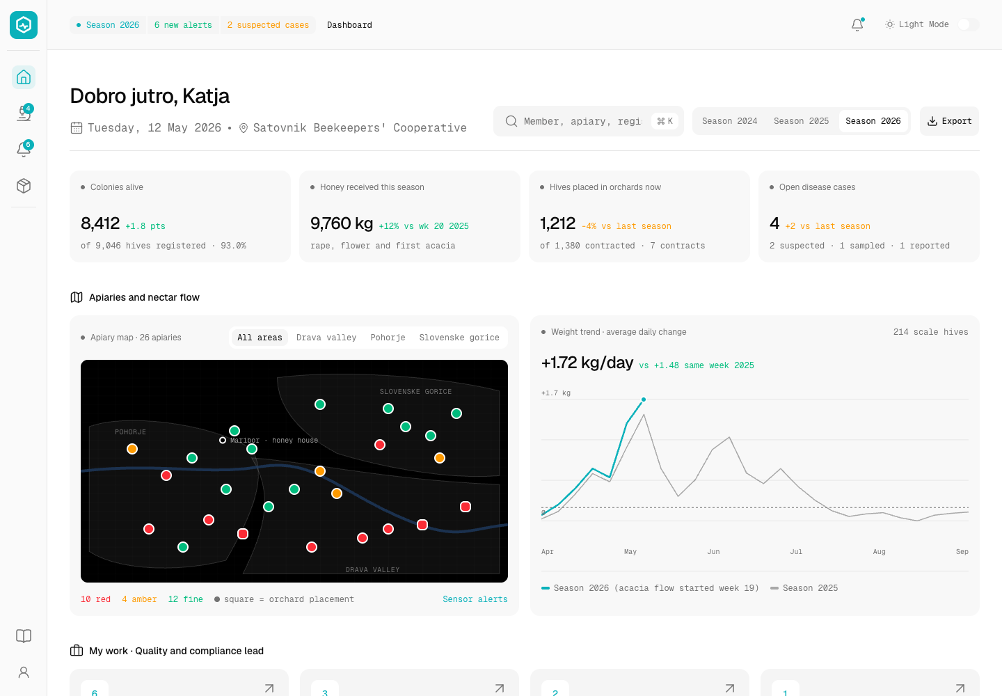
Hivewise - Hive Monitoring and Honey Traceability Platform for a Beekeeping Cooperative
Designed and built a clickable hive monitoring console for a beekeeping cooperative in Maribor, Slovenia: alerts from hive scales and climate sensors, notifiable disease cases up to the handoff to the official vet, honey intake with withdrawal and disease checks, and a batch trace from every jar lot back to the hives and members behind it.
Canopy Ledger - Forest Carbon Credit Registry with Satellite Monitoring
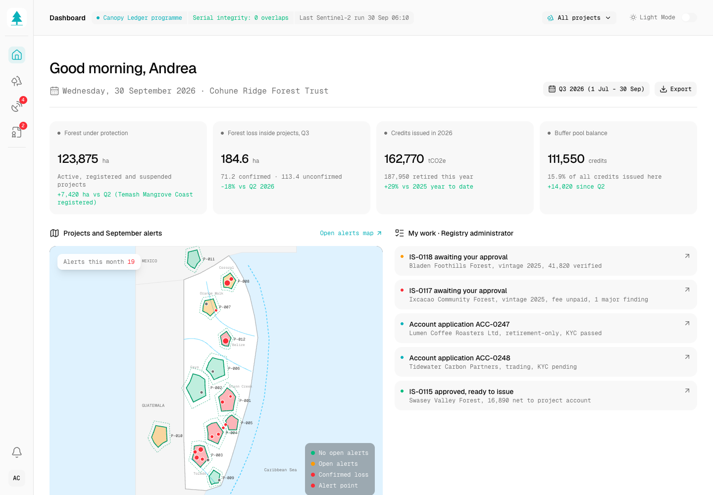
Designed and built a clickable registry and monitoring platform for a Belize forest carbon developer: every community forest project with its boundary and methodology, satellite forest-change alerts triaged to ground-truth, and issuance requests that only create serial numbers after a four-eyes check against verification, consent and double counting.
Enterprise Software Engineering - Human + AI
Contact Us
© 2026 - Copyright. All Rights reserved Oceanlab
Location
Global Headquarters
21 Merchant Road, 3rd Floor, Singapore 058267
Main corporate office and leadership operations
North America Office
548 Market Street, PMB 12345, San Francisco, CA 94104
Client operations and business development
India Office
402 Shivalik Shilp II, SG Highway, Ahmedabad 380015
Engineering and delivery center

Enterprise Software Engineering - Human + AI
Contact Us
Locations
Global Headquarters
21 Merchant Road, 3rd Floor, Singapore 058267
Main corporate office and leadership operations
North America Office
548 Market Street, PMB 12345, San Francisco, CA 94104
Client operations and business development
India Office
402 Shivalik Shilp II, SG Highway, Ahmedabad 380015
Engineering and delivery center
© 2026 - Copyright. All Rights reserved Oceanlab