Canopy Ledger - Forest Carbon Credit Registry with Satellite Monitoring
Carbon Credit Registry for a Belize Forest Trust
Designed and built a clickable registry and monitoring platform for a Belize forest carbon developer: every community forest project with its boundary and methodology, satellite forest-change alerts triaged to ground-truth, and issuance requests that only create serial numbers after a four-eyes check against verification, consent and double counting.
Most of our work is under NDA. Per agreement, we can share the work but not the company details - all names and identifying information shown here have been changed.
Impact
Dashboard with a map of every project, projects list with table, map and quick view, project detail with 8 tabs, forest change alerts with the alert quick view, and issuance requests with the issuance detail.
VVB report final, quantity matches, no earlier issuance for the period, no boundary overlap, FPIC valid, no open major findings, not issued on an external registry, and fee paid. Approve stays blocked until all pass and the approver is not the submitter.
Sentinel-2 and Landsat runs, GFW GLAD and RADD alerts and ranger reports, each with before and after cloud cover and NDVI change, moving through 6 statuses from new to resolved. A false alarm needs a reason.
Community forest, mangrove and savanna projects in Belize, Guatemala and Mexico, 2 of them mirrored from Verra and Gold Standard, with 22 alerts, 14 issuance requests, 3 VVB firms and 12 quarters of issued and retired credits.
The Problem
Cohune Ridge ran nine community forest projects from shapefiles on a laptop, ranger notebooks, a spreadsheet of serial ranges and a folder of scanned consent minutes. Deforestation inside a project was often noticed months later, when a verifier asked about it. Twice a buyer asked whether a block of credits had already been sold, and proving it had not took a week. Communities could not get a quick answer on what they had been paid.
Our Solution
Canopy Ledger holds each project's boundary, methodology and baseline, monitoring periods, satellite forest-change alerts, verification, serialised issuance, the buffer pool and the consent record in one registry. Analysts triage alerts to a ranger ground-truth, and an issuance request only becomes serial numbers after a second person approves it against a checklist that rules out double counting and missing consent.
The Challenge: One Tonne, One Credit, One Holder
Buyers now expect public proof that each forest carbon credit exists once, belongs to one holder and, once retired, can never be sold again. That proof depends on satellites, rangers, independent verifiers and the consent of the communities who own the forest.
Double Counting From Every Direction
Every credit needs exactly one serial and one holder. Serial ranges must never overlap, and the same tonnes must not be issued twice by two monitoring periods, two projects with overlapping boundaries, or Canopy Ledger and an external registry such as Verra.
Forest Loss Seen Too Late
Sentinel-2 sees at 10 m and Landsat at 30 m, but clouds block optical imagery for much of the year, so radar and Global Forest Watch feeds fill the gaps. Alerts are evidence, not proof, and a ranger has to confirm each one on the ground.
Consent Is a Hard Gate
Projects on indigenous and community land need free, prior and informed consent, and in southern Belize courts have recognised Maya customary land rights. Consent can be conditional or withdrawn, and issuance has to stop while it is missing.
Permanence and Host Country Rules
Forest can burn or be logged after credits are issued, so a buffer share of each issuance is held back: 15% by default and 10% to 25% by risk rating under the Trust's own policy. Credits authorised under Paris Agreement Article 6 need their status and letter of authorisation recorded.
Our Approach: From Crediting Rules to a Clickable Registry
Spec and Rules Research
Mapped 10 roles, from registry administrator and remote sensing analyst to VVB auditors, account holders and the public, and 51 screens across staff, verifier and holder portals, an offline ranger app and public registry pages. Modelled projects, boundaries, monitoring periods, alerts, plots, verifications, serial blocks, accounts, the buffer pool, FPIC and grievances, and wrote down the rules: VCS and Gold Standard references, ISO 14065 verifiers, buffer pools, FPIC, Article 6 and Belize's Data Protection Act.
Clickable Demo on a Production UI Kit
Built 5 key screens on a production map dashboard kit with a schematic map of Belize: the dashboard with forest, loss, credit and buffer KPIs, a project map coloured by alert status and the administrator's work list, the projects list, project detail with forest cover since baseline and holdings by serial range, the alerts workspace with list, map and quick view, and issuance requests with the pre-issuance checklist, buffer split and planned serial ranges. Triage, approval and issue all run on local state.
What a Production Build Adds
Integration with the Copernicus Data Space Ecosystem, Google Earth Engine and Global Forest Watch for imagery and alerts, Mapbox or MapLibre for boundary editing, reconciliation with the Verra and Gold Standard registries, DocuSign, Postmark and Twilio, and Stripe for registry fees. Role-based staff auth, an append-only audit log of every issuance, transfer, retirement and consent change, and the remaining screens: verifier and holder portals, the offline ranger app, community and grievance pages, and the public registry with retirement certificates.
Why It Works: Every Credit Traceable to Forest
Integrity Always in View
The top bar on every screen shows the programme, the serial integrity check (0 overlaps) and the time of the last Sentinel-2 run. Each issuance previews its serial ranges for the project and buffer accounts before anything is created.
Alerts Become Decisions
Each alert shows source, area, confidence, inside boundary or buffer zone, nearest plot and ranger team. The analyst sets severity, requests a ground-truth visit or marks a false alarm with a reason, and loss is confirmed only after the ranger has been.
Consent Blocks Issuance
Request issuance is enabled only with a verified monitoring period and valid FPIC. In the demo, a project whose community withdrew consent is suspended and its issuance request is rejected with the reason on screen.
Mirrors Never Issue
Projects issued on Verra or Gold Standard are marked as mirrors and their credits tab says so, while Canopy Ledger issuance checks the external registries for the same period before approval, so no tonne is counted twice.
Related case studies
View all: Climate & nature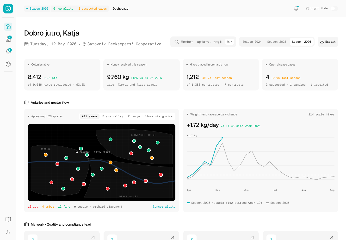
Hivewise - Hive Monitoring and Honey Traceability Platform for a Beekeeping Cooperative
Designed and built a clickable hive monitoring console for a beekeeping cooperative in Maribor, Slovenia: alerts from hive scales and climate sensors, notifiable disease cases up to the handoff to the official vet, honey intake with withdrawal and disease checks, and a batch trace from every jar lot back to the hives and members behind it.
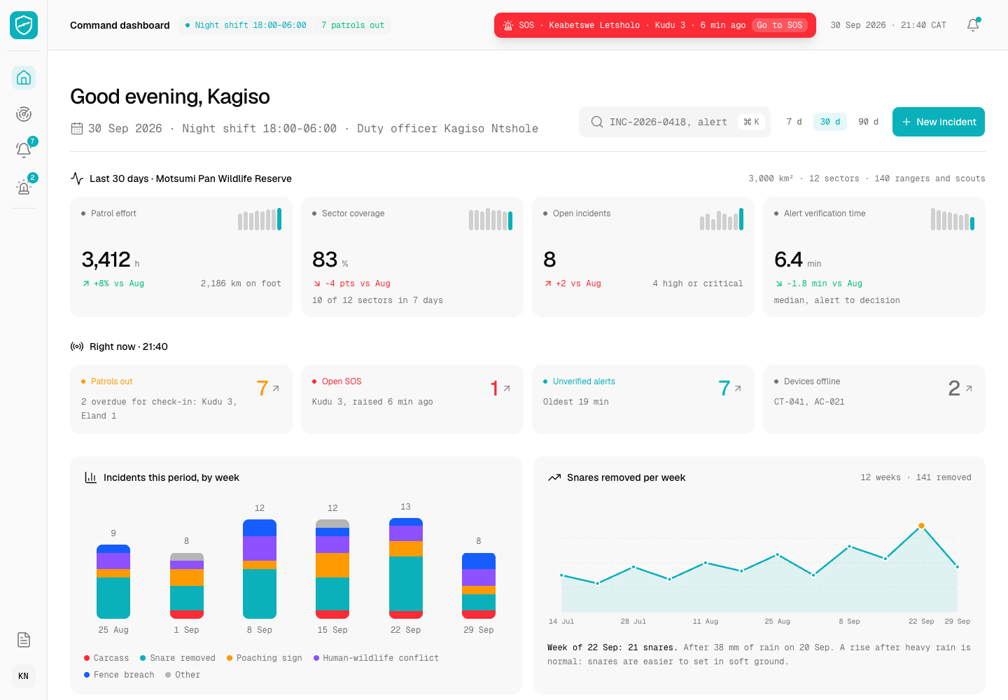
Ranger Line - Anti-Poaching Ops Room Console with Evidence Chain of Custody
Designed and built a clickable ops room console for a conservation trust protecting rhino, elephant and pangolin on a 3,000 km² reserve near Maun: a live map of patrols and ranger positions, sensor alerts verified by a person, and incidents with photos, evidence and an unbroken chain of custody - with exact rhino locations shown only to cleared staff.
Enterprise Software Engineering - Human + AI
Contact Us
© 2026 - Copyright. All Rights reserved Oceanlab
Location
Global Headquarters
21 Merchant Road, 3rd Floor, Singapore 058267
Main corporate office and leadership operations
North America Office
548 Market Street, PMB 12345, San Francisco, CA 94104
Client operations and business development
India Office
402 Shivalik Shilp II, SG Highway, Ahmedabad 380015
Engineering and delivery center

Enterprise Software Engineering - Human + AI
Contact Us
Locations
Global Headquarters
21 Merchant Road, 3rd Floor, Singapore 058267
Main corporate office and leadership operations
North America Office
548 Market Street, PMB 12345, San Francisco, CA 94104
Client operations and business development
India Office
402 Shivalik Shilp II, SG Highway, Ahmedabad 380015
Engineering and delivery center
© 2026 - Copyright. All Rights reserved Oceanlab